Sapa - Bac Ha - Lao Cai Overview
Introduction
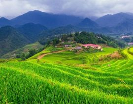
Lao Cai formed in 1907 and, after the changes in administrative, the last establishment was in 1991 by separating from Hoang Lien Son. It faces to Yun Nan (China) by 203km of borderline and, thus, places an important position of economy, politic and society. Lao Cai lies over mountains, hills and valleys with various climates: tropics, temperate zone where snow falls in coldest days. Besides of natural resources, Lao Cai is known of a famous destination for travelers, especially in the summer.
Lao cai, Sapa, Bac Ha is home of unrivalled mountain scenery, colorful minorities and Indochina's highest peak
Bac Ha is a district belonged the Northeast of Lao Cai which owns many beautiful landscapes with bold nature and history. Besides the spectaculars gifted by the nature such as majestic mountains, rivers and caves, kindly people, Bac Ha is also a convergence of colorful ethnic cultures, private specialties of the Northwest area. All create special appeal to hold foot of visitors when they come to Bac Ha, which may shown in Bac Ha Sunday market
Quick Facts:
Square: 6,384 Km2
Population: 646,800.
Average temperature: 20°C - 22°C
Administrative map includes 09 outside districts and Lao Cai town.
Area phone code: 020.
Minority: Viet, Tay, H’Mong, Dao, Nung, Cao Lan, Thai, Giay, Lu, Bo Y, Khang, La Chi, Phu La, Ha Nhi, Muong, La Ha.


.jpg)


.jpg)
.jpg)


.jpg)
.jpg)
.jpg)
